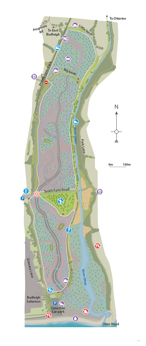
South Farm
Land on the east bank of the river was part of Otterton Barton until 1802 when South Farm was created.
Embankment
Big bank was also installed in the early 19th Century after the original “Little Bank” as Pulhayes farmland was wetter than it had been before.
A 170 metre section will be lowered to reconnect the River Otter to its floodplain. Footpath will be retained as part of the Lower Otter Restoration Project.
Agricultural Land
The reclaimed land was mainly used for grazing dairy cattle from the early 1800s to 2020s. Farmers recording losing livestock in years of flooding.
Aqueduct
The Budleigh Brook aqueduct was built ca. 1920 to carry the Budleigh Brook over the fields to make them less waterlogged and more suitable for grazing.
Embankment
The main 19th century embankment and ‘Little Bank’ were built in the early 19th century. They were designed by James Green and financed by Lord Rolle to reclaim land for agriculture to grow food for the nation during the Napoleonic wars. The river channel was also straightened at this time.
A 200 metre section will be lowered to field level to reconnect the River Otter to the floodplain. Footpath will be retained as part of the Lower Otter Restoration Project.
Lime kilns
Sites of lime kilns likely dating from the 17th Century can be found on both banks of the river. At these locations limestone (calcium carbonate) were burnt to produce ‘quicklime’ for building and lime for fertiliser.
Lime kilns
Sites of lime kilns likely dating from the 17th Century can be found on both banks of the river. At these locations limestone (calcium carbonate) were burnt to produce ‘quicklime’ for building and lime for fertiliser.
South Farm Road
South Farm Road was built at the level of the floodplain. Today, the road is impassable during heavy flooding events. It will be raised as part of the Lower Otter Restoration Project.
Harbour, quays and wharfs
The shingle bar created a sheltered harbour for small boats, which could once travel as far up the river as Otterton to trade.
Salmon pools
Pools were sited close to the shingle bar, and the current location of Lime Kiln car park. Historically locals could pay for a licence to fish in the river and pools.
Tip
The tip for household waste was first used in 1928 and was in use until 1978, gradually spreading east. As part of the Lower Otter Restoration Project, it will be capped and better protected from erosion.
Railway Line
The railway line arrived in 1897 for public transport and freight. After it stopped being a working railway in 1967 it became a private farm track for moving dairy cows.
Cricket Club (New Location)
Budleigh Salterton Cricket Club moved to the site in 1930 (from a previous site in Budleigh Salterton) and has often been flooded by the River Otter. It is being moved to higher ground as part of the Lower Otter Restoration Project.
Fishing
There is evidence of fishing for salmon and trout from the late 19th century but this would certainly have taken place much earlier too - indeed from the time of the first settlers to the valley. Recreational fishing continues to this day.
Trunk drain and outfall
Since the building of the embankment the only way the marshes have been able to drain is through an artificial outfall under the shingle bar.
Embankment
The main 19th century embankment and ‘Little Bank’ were built in the early 19th century. They were designed by James Green and financed by Lord Rolle to reclaim land for agriculture to grow food for the nation during the Napoleonic wars. The river channel was also straightened at this time. A 70m breach with be made in the embankment at the southern end of the site as part of the Lower Otter Restoration Project, which will be spanned by a new 70m footbridge to maintain access.
Walking
The lower Otter is now a popular spot for recreation and leisure and has one of the most-used footpaths in Devon, part of the South West Coast Path.
Cricket Club
Budleigh Salterton Cricket Club moved to the site in 1930 (from a previous site in Budleigh Salterton) and has often been flooded by the River Otter. It is being moved to higher ground as part of the Lower Otter Restoration Project.
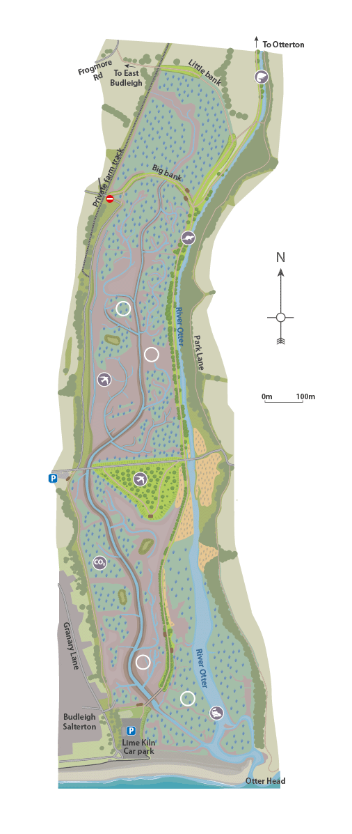
Beavers
The River Otter catchment has been the focus of a beaver reintroduction programme since 2015. It is the site of the first wild reintroduction of this species in England.
Beavers
The River Otter catchment has been the focus of a beaver reintroduction programme since 2015. It is the site of the first wild reintroduction of this species in England.
Fish
Estuaries play a crucial part in the life cycle of many fish species. They act as important nursery grounds for many marine fish including sea bass as well as vital corridors for migratory species such as salmon and sea trout. In the lower Otter estuary, sea bass, thin-lipped grey mullet and common gobies are common.
Otter
There is a healthy population of otters on the catchment. This species is generally solitary and territorial and nearly always found beside water. They mainly live along rivers, but are also found in and around canals, marshes, ponds, lakes, ditches, streams, and estuaries and along coasts. They mainly eat fish, but may also include frogs, crustaceans, molluscs, birds and even small mammals. Eels are a favourite food and, wherever they are plentiful they form a substantial part of the otter’s daily food.
Birds – saltmarsh and mudflat
These intertidal habitats of mudflat and saltmarsh are important feeding grounds for many species of bird. In the winter, you might expect to see bar-tailed and black-tailed godwit, curlew, ringed plover, dunlin, redshank, and brent geese. Rarer birds include grey phalarope, spoonbill, green and wood sandpiper, glossy ibis, ruff and spotted redshank.
Birds - scrub
Reed and sedge warblers occupy reed beds associated with saltmarsh with Cetti’s warbler, whitethroat, blackcap and chiffchaff common in scrub.
Carbon sequestration
Saltmarsh is one of the most effective habitats per hectare for carbon capture and storage, or sequestration. You can read more about why here.
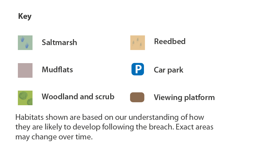
Saltmarsh
On slightly higher ground than mudflat, this vegetation is submerged by the tide at some point of the tidal cycle, but not necessarily daily. Saltmarsh provides a home for a wide range of specially adapted salt-tolerant species, some of which only occur where the sea meets the land. They are dynamic and complex habitats and are vulnerable to disturbance.
Mudflats
These are the ‘muddy’ areas that are covered by the sea at high tide and exposed at low tide. They are created by deposited fine silts and clays that build up in layers. They are an important part of coastal defence as they absorb wave energy. They are also biologically important as they are home to large numbers of invertebrates.
Saltmarsh
On slightly higher ground than mudflat, this vegetation is submerged by the tide at some point of the tidal cycle, but not necessarily daily. Saltmarsh provides a home for a wide range of specially adapted salt-tolerant species, some of which only occur where the sea meets the land. They are dynamic and complex habitats and are vulnerable to disturbance.
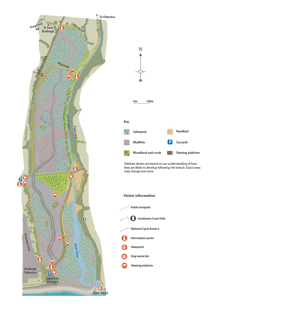
Big Bank viewing area
Viewing area with bench and information boards on Big Bank. View across the newly created creeks, mud flat and salt marsh of the northern end of Big Marsh. Level with footpath, no steps.
Little Marsh viewing area
Viewing area with bench and information boards on Big Bank. Overlooks the newly created salt marsh of Little Marsh facing north towards Little Bank. Level with footpath, no steps.
The Island viewing area
Large viewing area with benches and information boards located on the site of a former tip replanted with trees and scrub. Facing south towards the sea, enjoy views over the newly created creeks, mud flat, lower saltmarsh and islands of the southern end of Big Marsh. Level with footpath, no steps.
Big Marsh viewing area
Viewing area with bench and information boards on the main embankment. From here enjoy views over the newly created creeks, mud flat and lower saltmarsh of the southern end of Big Marsh, facing west toward Granary Lane and the sandstone cliff. Level with footpath, no steps.
River Otter viewing area
Viewing area with bench and information boards located on the main embankment. Facing east, enjoy views across well-established intertidal habitat on the main river channel which flows past the sandstone cliffs and iconic treeline at Otter head. Level with footpath, no steps.
Lime Kiln viewing area
Viewing area with benches and information boards that overlook the newly created mud flat, lower saltmarsh and the main creek. From here look northwards up the valley across the southern end of Big Marsh. Shallow sloped path from car park, no steps.
Otter Estuary Nature Reserve car park
Managed by the Pebblebed Heaths Conservation Trust
2.2m height restriction in place, no overnight parking. Dog waste bins and cycle rack, nearest public toilets Budleigh seafront.
Visitor information point and viewing area overlooking the estuary with benches. Sloped footpath leads down to the nature reserve footpaths and the minor road, no steps. Path surfaced with self-binding gravel. South Farm Road, Budleigh Salterton, EX9 7AZ
Lime Kiln Car park
Managed by EDDC Car park locations and information - East Devon
Visitor information point, benches, litter and dog waste bins. Public toilets located on the seafront. Shallow sloped access up to viewing area and on to main footpath. Footpath with self binding gravel surface, no steps.
Granary Lane, Budleigh Salterton, EX9 6JD